» Granada, España [map]
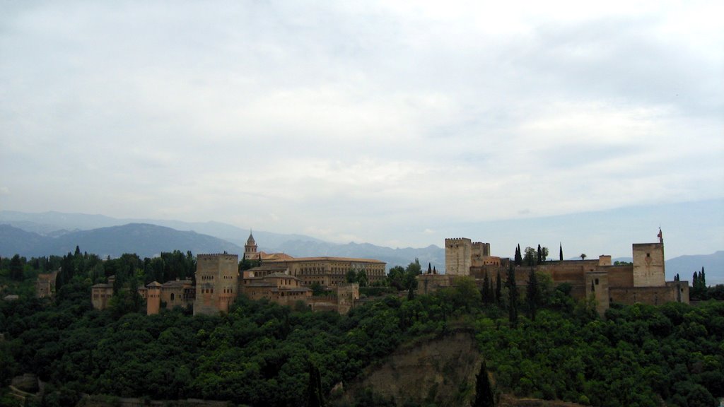
The Alhambra (Arabic: الحمراء = Al-Ħamrā; literally "the red one"; the complete name is "Qal'at al-Hambra", which means "The red fortress") is a palace and fortress complex of the Moorish rulers of Granada in southern Spain (known as Al-Andalus when the fortress was constructed), occupying a hilly terrace on the southeastern border of the city of Granada. Once the residence of the Muslim rulers of Granada and their court, the Alhambra is now one of Spain's major tourist attractions exhibiting the country's most famous Islamic architecture, together with Christian 16th century and later interventions in buildings and gardens that marked its image as it can be seen today. Within the Alhambra, the Palace of Charles V was erected by Charles V, Holy Roman Emperor in 1527. The terrace or plateau where the Alhambra sits measures about 740 m (2430 ft) in length by 205 m (674 ft) at its greatest width. It extends from WNW to ESE and covers an area of about 142,000 m². Its most westerly feature is the alcazaba (citadel); a strongly fortified position. The rest of the plateau comprises a number of palaces, enclosed by a relatively weak fortified wall, with thirteen towers, some defensive and some providing vistas for the inhabitants. The river Darro passes through a ravine on the north and divides the plateau from the Albaicín district of Granada. Similarly, the Assabica valley, containing the Alhambra Park on the west and south, and, beyond this valley, the almost parallel ridge of Monte Mauror, separate it from the Antequeruela district.
The Alhambra (Arabic: الحمراء = Al-Ħamrā; literally "the red one"; the complete name is "Qal'at al-Hambra", which means "The red fortress") is a palace and fortress complex of the Moorish rulers of Granada in southern Spain (known as Al-Andalus when the fortress was constructed), occupying a hilly terrace on the southeastern border of the city of Granada. Once the residence of the Muslim rulers of Granada and their court, the Alhambra is now one of Spain's major tourist attractions exhibiting the country's most famous Islamic architecture, together with Christian 16th century and later interventions in buildings and gardens that marked its image as it can be seen today. Within the Alhambra, the Palace of Charles V was erected by Charles V, Holy Roman Emperor in 1527. The terrace or plateau where the Alhambra sits measures about 740 m (2430 ft) in length by 205 m (674 ft) at its greatest width. It extends from WNW to ESE and covers an area of about 142,000 m². Its most westerly feature is the alcazaba (citadel); a strongly fortified position. The rest of the plateau comprises a number of palaces, enclosed by a relatively weak fortified wall, with thirteen towers, some defensive and some providing vistas for the inhabitants. The river Darro passes through a ravine on the north and divides the plateau from the Albaicín district of Granada. Similarly, the Assabica valley, containing the Alhambra Park on the west and south, and, beyond this valley, the almost parallel ridge of Monte Mauror, separate it from the Antequeruela district.
Comments
Post a Comment